- News
- City News
- kochi News
- Wayanad tragedy: ‘Crown’ of 1,550m, debris travelled 8km along Mundakkai river; damage extent 86,000 sqm
Trending
Wayanad tragedy: ‘Crown’ of 1,550m, debris travelled 8km along Mundakkai river; damage extent 86,000 sqm
Twin landslides in Kerala's Wayanad district caused significant damage, claiming over 170 lives and injuring at least 200 people. High-resolution satellite imagery from Isro's NRSC revealed extensive landscape alterations, including the widening of the Mundakkai river. This disaster might be a reactivation of a previous landslide, underscoring the area's vulnerability to such events.

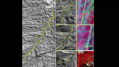
Isro’s Risat radar and Cartosat-3 optical imagery have enabled a detailed assessment of the landslide’s devastation. The data reveals that the disaster dramatically reshaped the landscape, widening the river and causing breaches in its banks
The National Remote Sensing Centre (NRSC), a key centre under Isro, has revealed the extent of the damage through high-resolution satellite imagery.
The landslide, originating at an altitude of 1,550 metres near Chooralmala town, triggered a massive debris flow that travelled an astonishing 8km along the Mundakkai river.

Towns and settlements in its path have been devastated, with houses and infrastructure suffering significant damage.
Satellite images captured by Isro’s Risat and Cartosat-3 provide a stark before-and-after comparison of the affected area.
The Risat’s cloud-penetrating radar and Cartosat-3’s advanced optical capabilities have allowed for a detailed assessment of the disaster’s impact.
The NRSC report indicates that the landslide has dramatically al tered the landscape, widening the Mundakkai river and causing breaches in its banks.
Alarmingly, the report suggests that this disaster may be a reactivation of a previous landslide in the same location, highlighting the area’s known vulnerability to such events.
The NRSC report reads: “A major debris flow was triggered by heavy rainfall in and around the Chooralmala town of Wayanad. Very high resolution Risat synthetic aperture radar (SAR) images of July 31 shows the entire extent of the debris flow from crown to end of run out zone. The approximate length of the flow is around 8km. The crown zone is a reactivation of an older landslide.”
“...The size of the main scarp of the landslide is 86,000 sq m. The debris flow has widened the course of the Mundakkai river causing breach of its banks. Houses and other infrastructures located along the banks have been damaged by the debris flow,” it added.
NRSC scientists have developed a new method for rapid landslide detection using satellite imagery and deep learning techniques. “Previously, manual or semi-auto matic mapping of landslides after major events like heavy rainfall was time-consuming. The new approach, using a deep learning model called DeepLabV3+, is ideal for rapid regional mapping, essential for disaster mitigation and quick response,” as per NRSC.
The model was developed for mapping landslides in the Himalayas and Western Ghats of India — including Wayanad and Kodagu districts in Kerala and Karnataka, respectively.
“The method was tested in parts of Maharashtra, Kerala, Karnataka, Mizoram, and Uttarakhand, with results compared to past landslide inventory data. This timely detection of landslides is valuable for disaster management and mitigation planning, especially in inaccessible terrain where satellite data plays a crucial role,” NRSC said.
In Feb 2023, Isro had released the Landslide Atlas of India, documenting around 80,000 landslides across 17 states and two Union Territories in the Himalayas and Western Ghats from 1998-2022. The atlas ranked 147 districts based on landslide exposure and socio-economic factors, with Wayanad identified among the vulnerable districts.
End of Article
FOLLOW US ON SOCIAL MEDIA


